The Grand Canyon is a must-do hike for any backpacker. Even though permits for the campground at Bright Angel are hard to come by, we lucked out on walk-in permits. Bright Angel campground is gorgeous and the hike to Ribbon Falls was a great day hike. Over 4,000 feet up and down, this hike isn't easy, but the views are one of a kind.
Backpacking Trip Info
Dates: Mar 25 - Mar 27
Miles: 27.4 roundtrip
Elevation Change: 4,730
Trail Type: Loop
Trailhead: Google Maps

Getting There
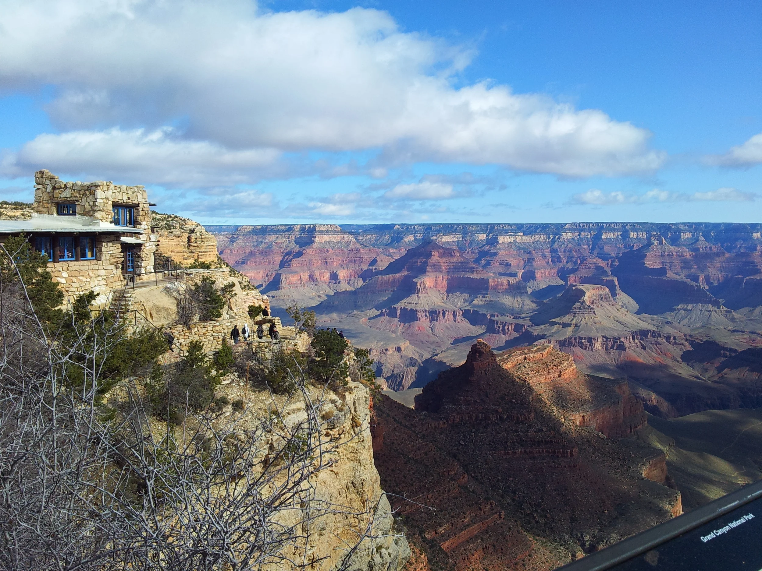
We drove the 8 hours to Flagstaff, AZ and got a cheap motel to crash in before waking up early and trying to get a walk in permit at the wilderness office. After waiting in line, we didn't get a walk in for the day, so we headed out to explore the rim of the Grand Canyon, something we weren't expecting to enjoy as much as we did since it was so touristy.
We walked the rim for a little, and the air temperature was quite cold and still had snow in some places. We were all bundled up in jackets, hats, and gloves, and we couldn't explore the North Rim because the roads were still closed.

The stunning view from the South Rim

Since all lodging on the rim was so expensive, and camping would just be too cold, we headed back to our hotel in Flagstaff and promised to return early the next day. When we got to the wilderness office, we weren't hopeful since there was already a crowd and spring break seemed to draw a large amount of visitors. Just by luck, we managed to land a permit and camp spot for Bright Angel! Ecstatic, we headed to the TH (7,260') to pack our packs.
The Hike
Since this was our first backpacking trip, we didn't have hiking boots, no sleeping pads, and Kyle and I had one sleeping bag to share. Kyle even had hand surgery that month and sported a black thumb cast on the trail (so many people on the trail asked if he hurt it at the Grand Canyon :D). Looking back on this trip, we laugh at how unprepared we were. In a way this trip has made us realize that we don't need the fancy gear to go backpacking, but that having the right gear can make a trip more comfortable.
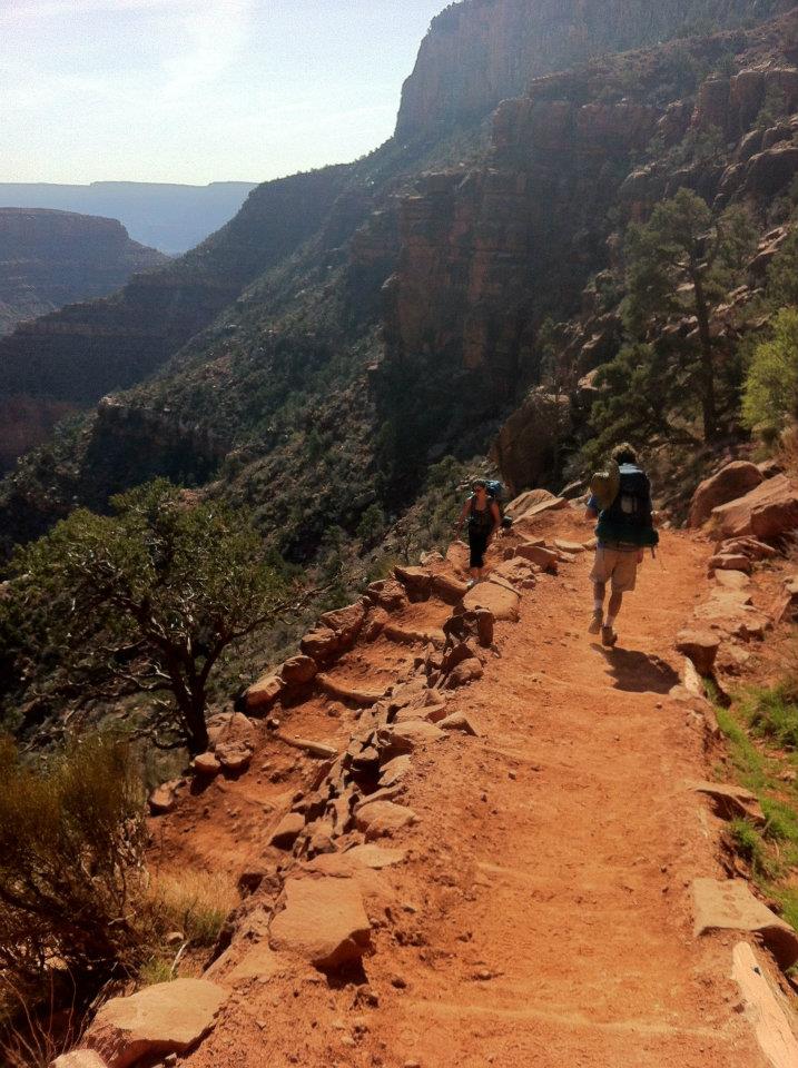
The South Kaibab trail is 6.8 miles to Phantom Ranch and another 0.2 miles to Bright Angel Campground, involving 4,730' of descent.


There were lots of donkey trains carrying people and packs on the trail. We often had to pull over to the side (pick the canyon wall side so they don't knock you over the cliff) to let them pass.

Hiking downhill with a full pack was harder than I imagined. After all of the steps down, my quads were shaking and we were not even close. The beautiful scenery around me definitely helped take my mind off my tired legs.


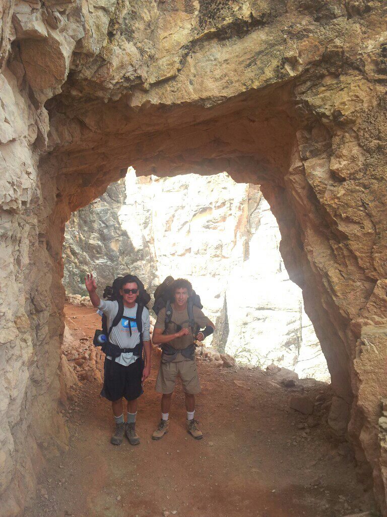
The scenery was quite diverse, and at 6.3 miles we even passed through a tunnel that emerged into a beautiful suspension bridge.


As we reached the campground, we were surprised how warm and picturesque the bottom of the canyon was compared to the top. The Bright Angel Creek flowed right through the campground, and white cotton wisps floated around in the wind. Bright Angel has 33 camp sites, toilets, and water. After we set up camp, we headed to the sandy beach by the Colorado River to go for a swim and cool off after our long hike.

That night we hiked back to the bridge to watch the stars, and we even saw some bats in the tunnel that we came from. The next day we decided to hike to Ribbon falls. The 5.6 miles to Ribbon falls was along the North Kaibab trail. It was only 1,200' elevation gain and followed the river through the canyon and through some open desert fields. We saw Ribbon falls in the distance and crossed the river to reach it.


We stayed in the shade of the 2nd tier and found a small alcove to hang out in. The view from the cave was amazing, and the moisture from the waterfall mist created a great habitat for mosses and ferns to grow. After spending several hours up there, we decided to get a head start on our hike home.


Where we stopped to have our pizza lunch on the way back
When we got back to our camp spot, we did some bouldering up the rocky wall of our camp spot and then went to hang out on the sandy beach again. After some whiskey and cards, we called it a night. The next morning we woke up early and headed out on the dreaded hike back up. Even though our packs were the lighter, it was still a 4,360 mile ascent over 9.6 miles.


We had to stop for about 10 minutes because I got a bloody nose. Trying to get as far ahead on the trail as possible before the sun reached full force, we eventually reached Indian Campground. There were about 15 camp spots, toilets, and water. We even saw a doe on the trail here!


The worst part was seeing the final steep section back up to the top. It seemed like we had already climbed so far, but looking up at the sheer cliff was quite daunting.

The air got icier as we climbed, and we passed some wet patches of mud and snow. We passed lots of day hikers astonished to see us lugging our large packs, and many asked whether we climbed from the canyon floor.

There was a group of people enjoying the view from lawn chairs set up by the trail, cheering me on the final 100 feet.

Since it was my first backpacking trip ever, the Grand Canyon will always hold a special magic for me. It was the hardest hike for me, mostly because I had never hiked anything over 4 miles before. But even so, the beautiful views the whole way through made it worth it. I would love to go back and explore the North Rim.
Other Useful Sites: