
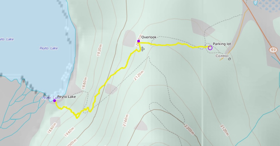
Instead of just stopping at the same viewing platform as everybody, we decided to escape the crowds and head down to the actual shore of Peyto Lake via the Caldron Peak Trail. This short but steep hike offers unique perspectives of this iconic lake that is normally only seen from above.
Hike Info
Date: Sep 21
Miles: 2.5 roundtrip
Elevation Change: 1,161 ft
Trail Type: Out and back
Trailhead: Google Maps
Cost: Banff National Park entrance fee required
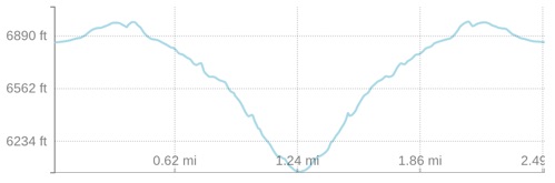
Elevation profile of the hike
Getting There
Because of the easy access to the viewing platform, this is one of the more popular stops in Banff. Get here early or go on a weekday, as there will be no shortage of tour buses here, and there is limited parking in the lot.
Tip: Be sure to download offline Google Maps of the area beforehand, as service is limited in this area!
The Hike
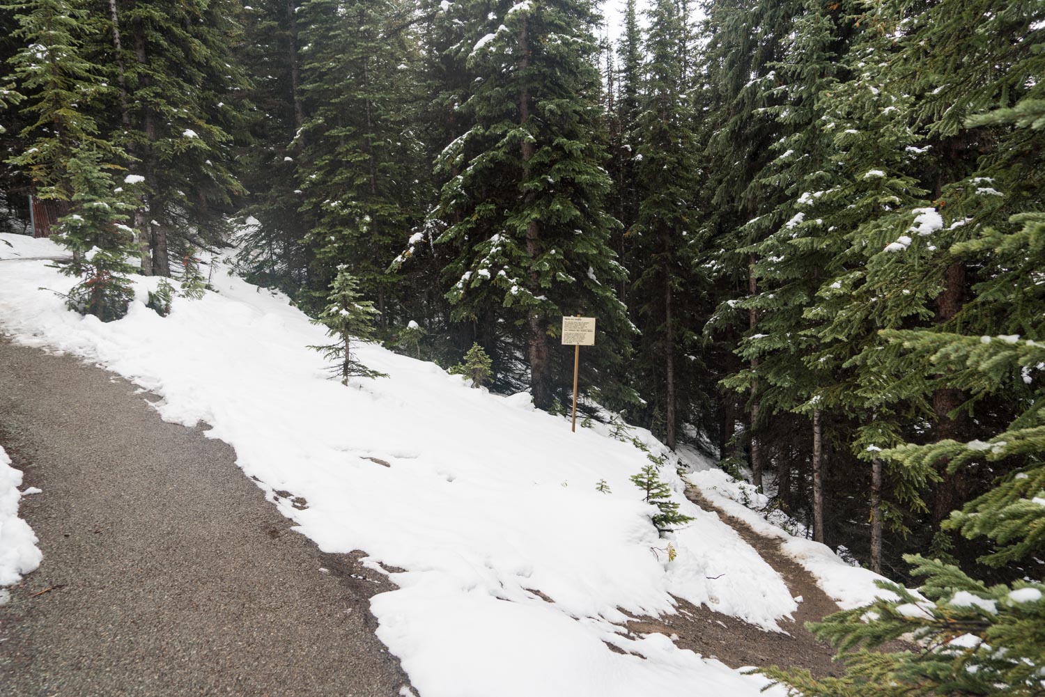
There is a flat, paved path leading from the parking lot that you will be following. Take care in the winter, as the smooth path can have some serious icy spots.
After about 0.4 miles, you’ll reach an opening in the trees and a view of the turquoise Peyto Lake below. This area can be quite crowded, but once you snap a few pictures and finish taking in the view from up here, continue on the paved path until you see a small trail branching off to the right.
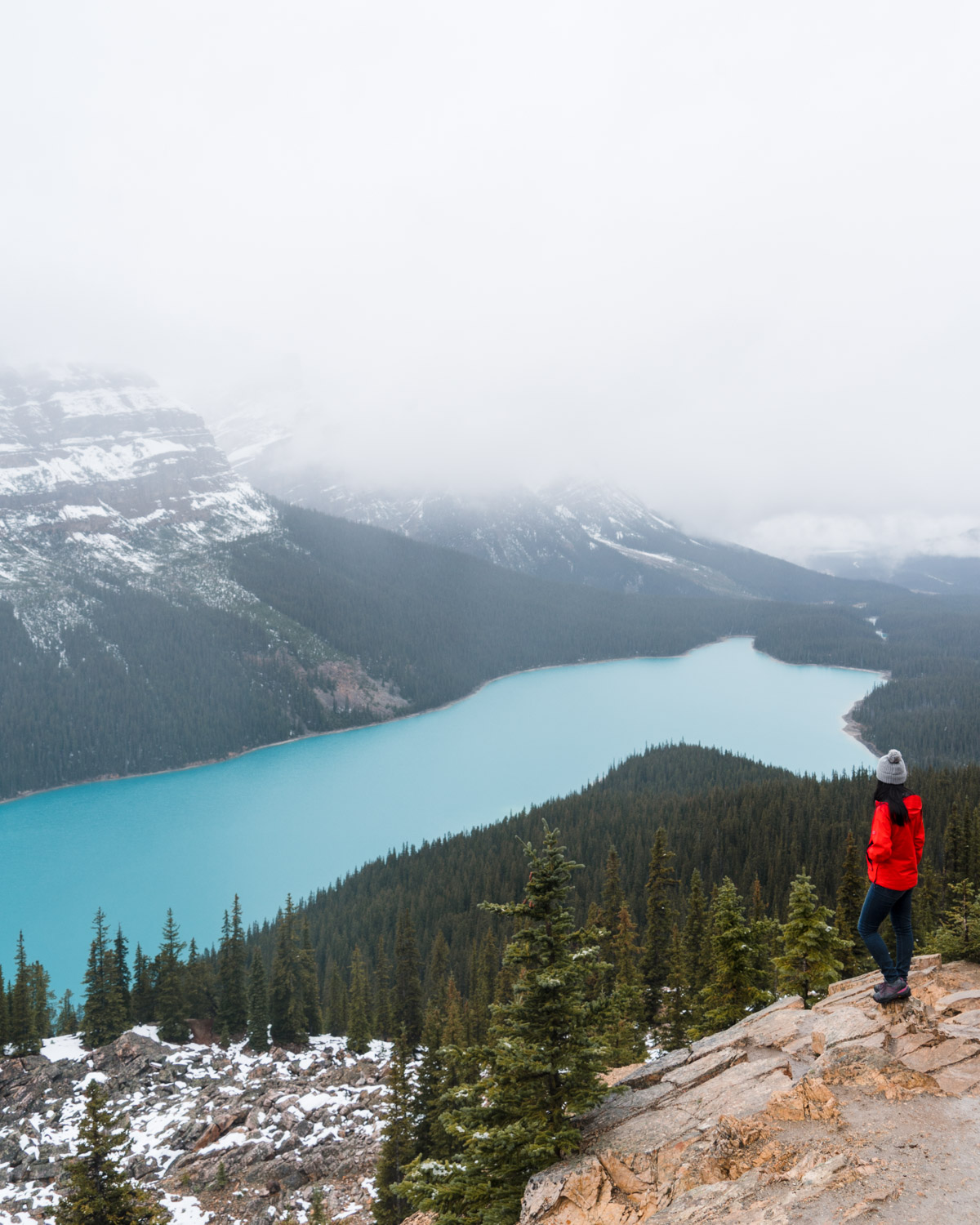
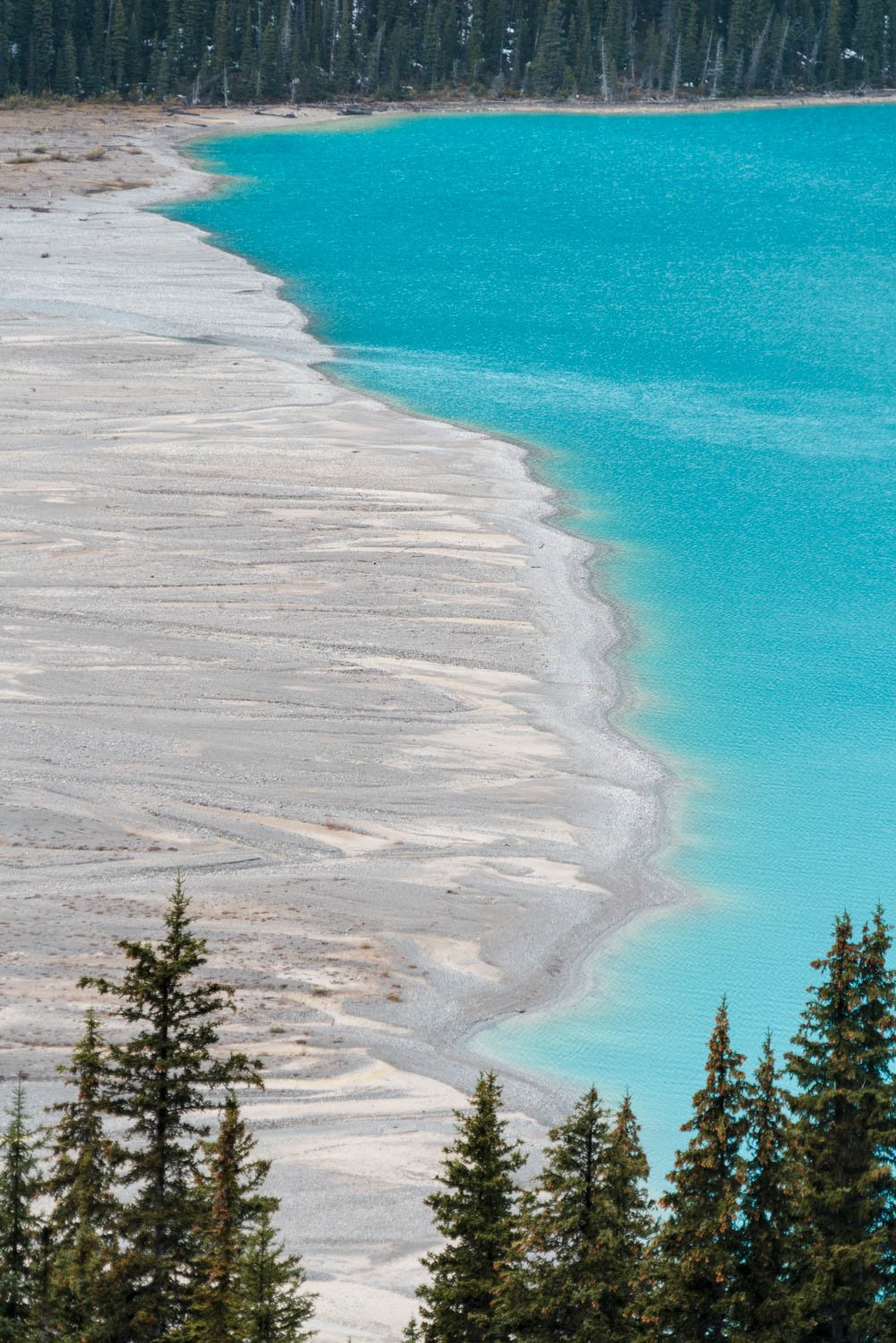
Peyto Lake is a glacier-fed lake, so its incredible color can be attributed to the minerals and rock flour that are deposited by melting glaciers. My favorite time to see the lakes at their bluest or most turquoise is when it is sunny out and towards the end of summer once more of the glaciers have had a chance to melt.
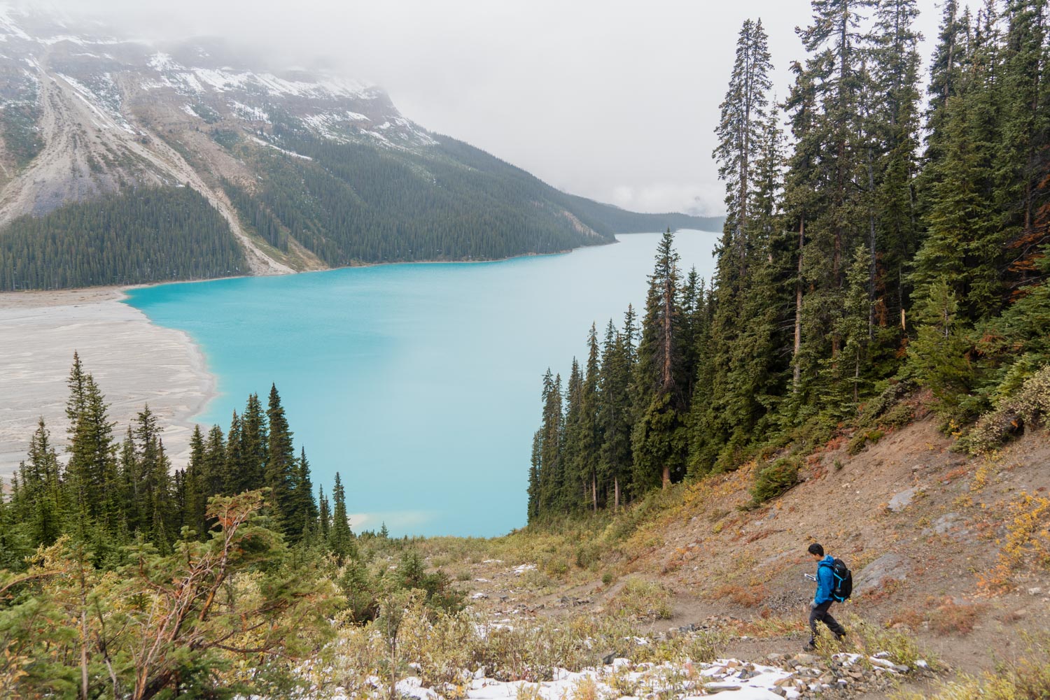
The trail heads straight into the forest and starts descending steadily down towards the lake. Along this part of the trail we were able to get the occasional glimpse of Peyto Lake, which would occasionally come in and out of focus through the snow clouds.
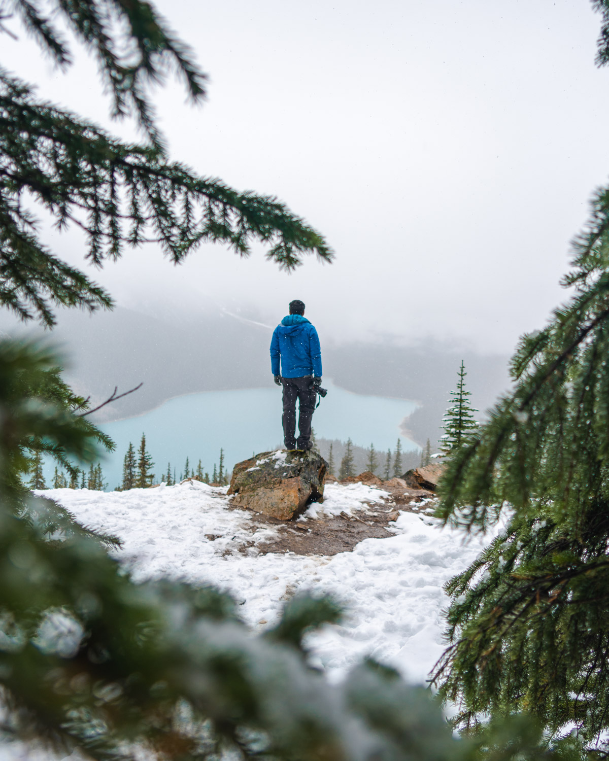
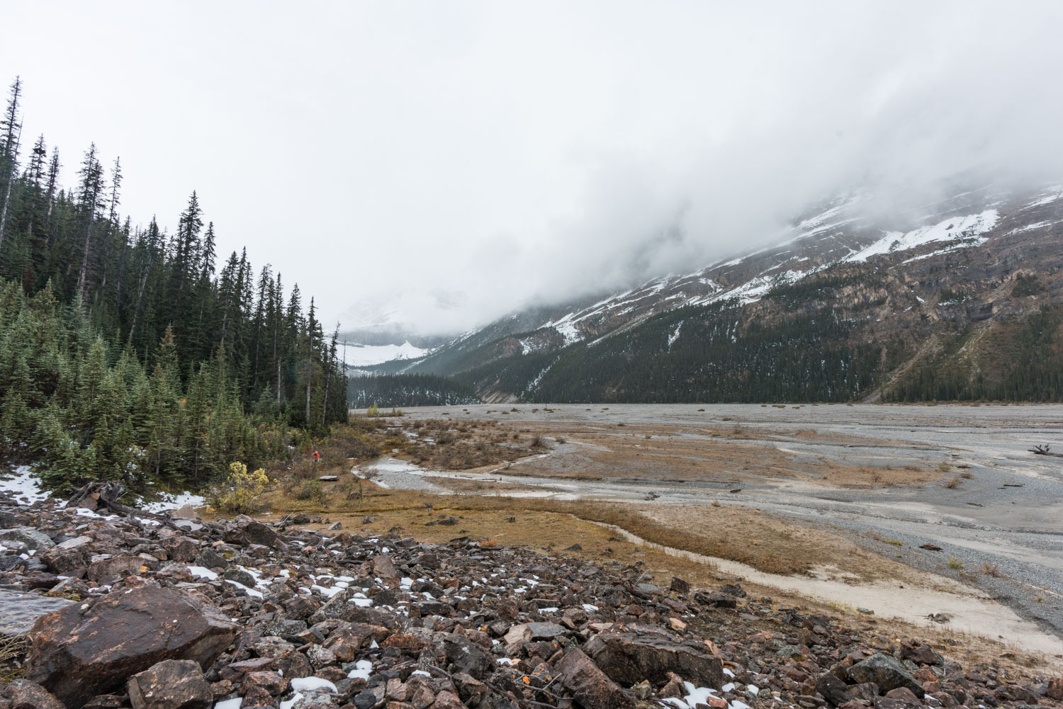
Soon the trail becomes a series of switchbacks, and we have now traveled south enough to clearly see the edge of the lake being fed by runoff from the melting glacier. We could barely see Peyto Glacier all the way on the other side of the valley, but the small inlet streams winding all the way to the lake shore made for some interesting soil patterns.
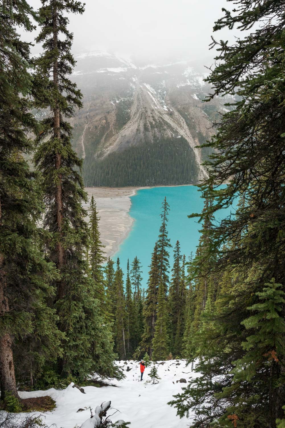
The trail eventually emerges out from the trees onto this steep ravine, where you’ll descend on nonstop switchbacks all the way down to the water.
Starting the descent down the ravine to the lakeshore
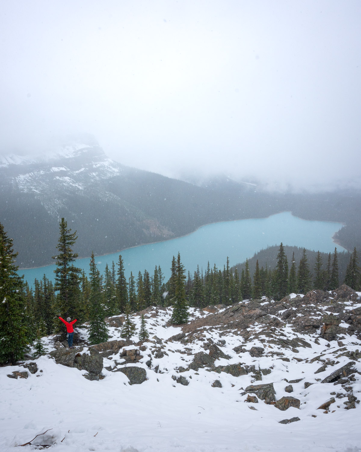
After a total of 1.3 miles of hiking, we got to the bottom and were able to explore much of the shore with nobody around. Peyto Lake looked completely different from this angle, and the mountains bordering the lake, the Waputik Range, seemed much more grand from down here.
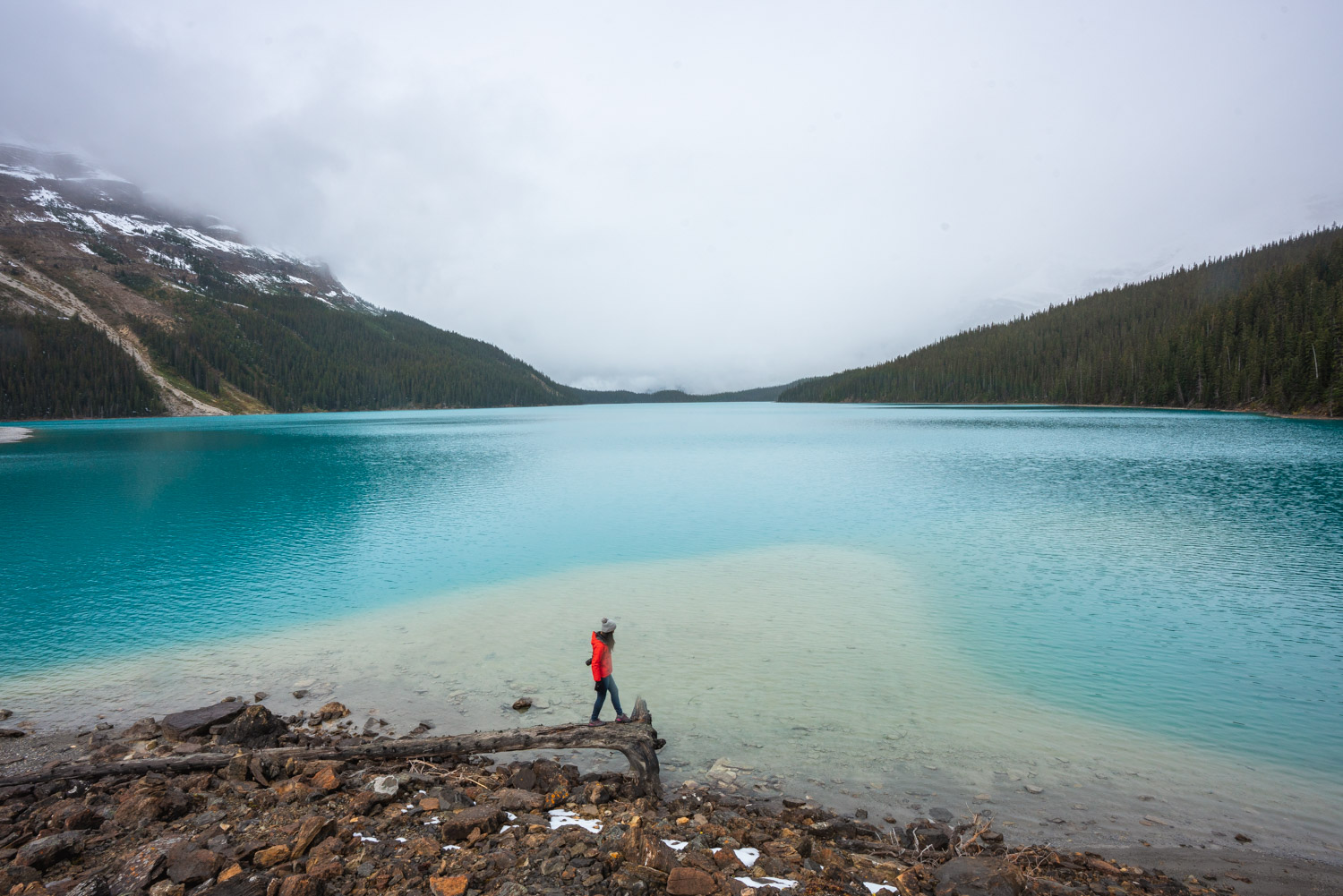
Peyto Lake still looking blue even on an overcast day
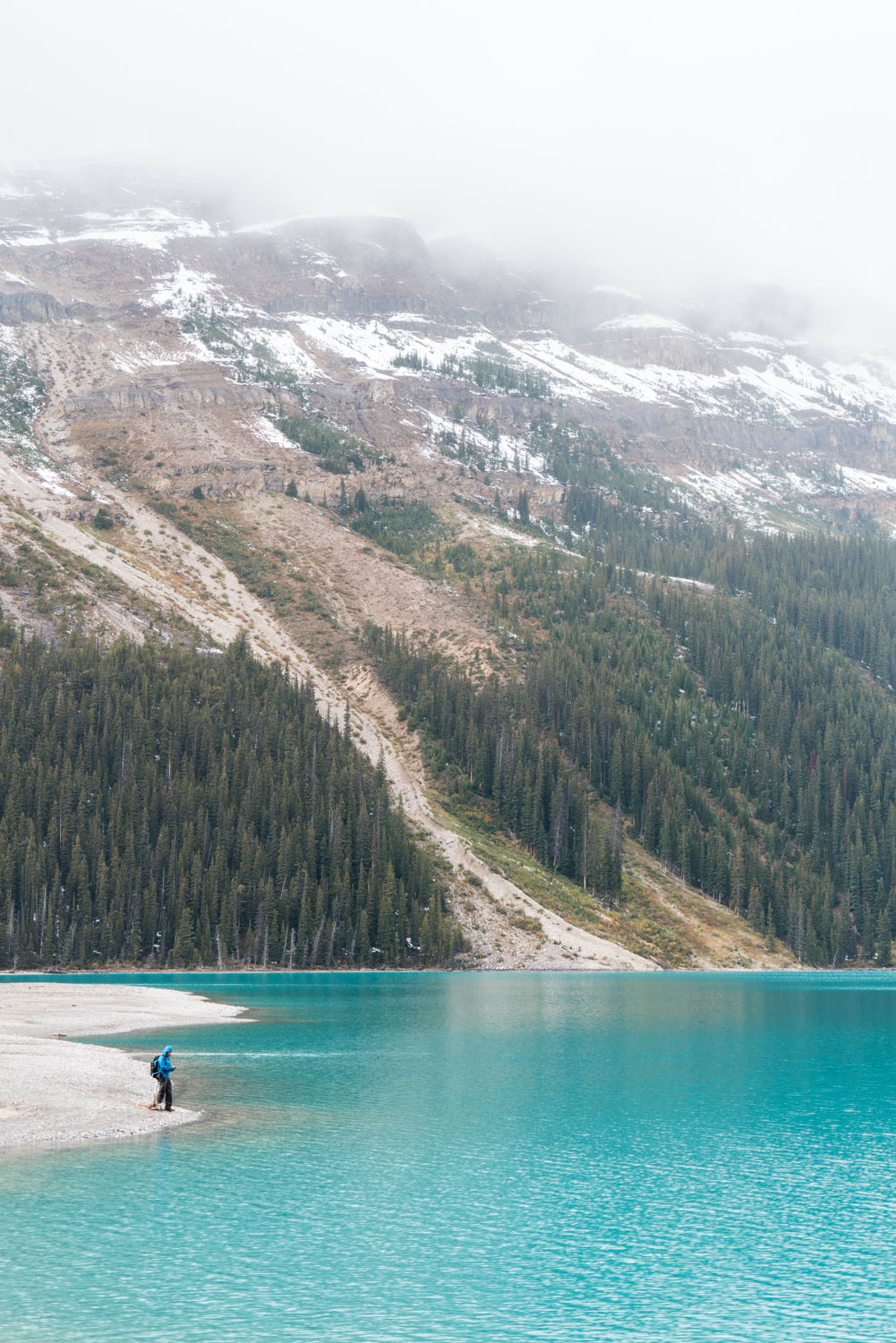
After enjoying the quietness of the lake for a while, we started hiking back up to the platform that sat 775 feet above us to continue on our journey through the Icefields Parkway. I loved this mini hiking excursion, as it was one of the few places during our five day Banff trip that we didn’t see a single soul around.
